Interview
From the Orbit into the Earth’s Crust
Seismometers usually detect earthquakes when it is too late. Jonathan Bedford is working with a technology that promises more foresight.
Professor Jonathan Bedford uses GPS technology to measure movements of the Earth’s crust. In doing so, he is trying to track down the origin of earthquakes. The movements of the individual plates in the Earth's crust lead to tensions and faults, which can be released in the form of earthquakes. In this interview, Bedford explains why it is so complicated to predict earthquakes, talks about the challenges of field work and remembers how he experienced his first earthquake.
Professor Bedford, why is it so difficult to predict earthquakes?
I think it is because we can’t get the instruments close enough to the faults at which the earthquakes originate. The parts of the tectonic plates that are moving across each other or where the plates are broken are often difficult to access because they are in remote places and many kilometers underground.
What kind of places?
The biggest earthquakes are subduction earthquakes, where one tectonic plate dives under the other. This often creates magnitude 8 or 9 earthquakes. Most of them happen under the ocean, it is very difficult to get data there.
Another reason is the cost of the measurement equipment. The hardware itself was very expensive. Now, it is coming down in cost, and we are at a point where human logistics become the most expensive aspect because we have to train people to do the field work. I think we don’t spend anywhere near enough money as a field, considering how many lives are at stake.
You are using GPS technology instead of seismometers to monitor geological movements? How precise is this technology?
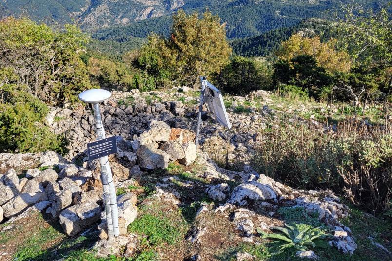
With the best equipment that we have, we can measure ground positions with a precision of a few millimeters in the horizontal, and just over one centimeter in the vertical direction. With mobile phones, GPS usually gives us a resolution of five to ten meters. But mobile phones only use signals of one frequency. We use multiple frequencies. Because of this we can make more accurate measurements. But we have to be quite careful in our analyses.
Measuring tectonic plate movements with GPS
Measuring tectonic plate movements with GPS
Why is that?
The technology works with satellites that are orbiting Earth at a certain speed. They experience a different gravity than the Earth’s surface leading to some relativistic effects. Time is running at a different speed in the satellites’ orbit and on Earth. We have to do some fancy maths and physics to correct for that.
You and your team implemented a lot of measurement stations in Greece in 2024. Why especially there?
Greece is one of the most seismically hazardous regions in Europe, but there is a lower density of stations compared to other countries. There are also some interesting tectonics for our kind of research.
Monitoring microplates in Greece
Monitoring microplates in Greece
How many stations have you put out?
So far, 49 in Greece. Over the next months, we hope to get another 23 out. Working in the field is always unpredictable. You can plan to put a station somewhere, but then it turns out not to be a good location. Or you agreed to meet someone and for whatever reason that person couldn’t make the appointment.
Where exactly do you put your stations?
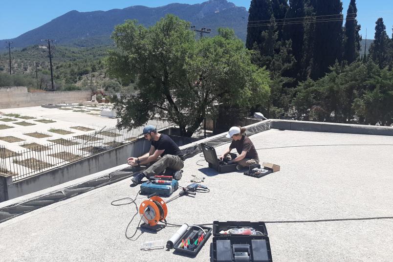
In Greece, we get permission to drill into the roofs of public buildings, so we can fix our antennas there. We either power them with a solar panel and battery combination or connect them to the electricity of the buildings. Installing one station takes us about three to four hours on average. Usually, we do one station per day. We try to get it done in the morning and then go to eat some nice Greek food.
I’ve also done a lot of work in Chile, where we generally drill the stations into bedrock.
What are the biggest challenge during field work?
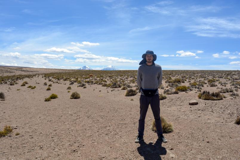
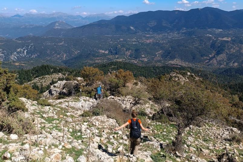
It is different things in different places. In Greece, the challenge is managing the heat. In the south of Chile, it’s the insects that are very annoying. In the north of Chile, it’s the danger of being in the desert; you can be hundred of kilometers from anywhere safe, so you have to plan ahead not to get stranded.
Have you ever experienced an earthquake during your travels?
Some. The first proper one was in Chile in Concepción. There had been a magnitude 8.8 earthquake in 2010 there. I was close to the epicenter of that two years later, and there were still aftershocks going on. It was a magnitude 5.8 – and a very weird experience. At first, my brain tried to tell me, it was not an earthquake. It was trying to rationalize it some other way. But then it started kicking. People in the streets were wailing. They were scared because they were still traumatized from the large earthquake in 2010.
Later, I felt another one in the north of Chile, magnitude 6. I was in a hotel. A lot of children started crying, which was a bit distressing. I was getting ready to run up the evacuation route to higher ground. But in the end, we did not have to evacuate.
For your field work, you pick some of the most seismically dangerous regions in the world. Are you not anxious?
You gotta go where the signal is. I am aware of the general hazard, but I am not anxious. When working in Chile, someone gave me the advice to always have water, which is apparently the most important thing if you experience a big earthquake. So I always stick to that advice. You have to consider that many people – one in three globally – are living in a site exposed to seismic hazard. Therefore, there is nothing too special in going to such a place.
Is it important to you to do the field work yourself?
Very important. Unfortunately, in geophysics some of people are doing the research, but they are not contributing much to field work – maybe because of the time pressure in academia or because they never had the opportunity. But ultimately, I think we need more data. It is a bit out of balance that we have a lot of research projects on existing data going on, but not so much gathering new data. There is not enough training in field work going on, and not enough appreciation of the field work. It can also be very expensive, so we need to find a sustainable way to do it. We also need a better way to coordinate field work at the international level. It is something I have to talk more about with colleagues, at least for GNSS stations.
Despite all the challenges, you seem to enjoy the field work.
You meet great people in the field. If you’ve been in a tent with someone in some remote place, you have a special bond.
What are your wishes for your future scientific career?
If I’m lucky, I have another 30 years of research ahead of me. In that time, I would like to see the community in my field to be less reactive, and more proactive. Changes are already happening.


