Software tool
Identifying potential CO2 savings through timber construction
If wood were to become more widely used as a building material, the climate could benefit significantly. A novel tool shows to what extent this would be the case in individual residential areas.
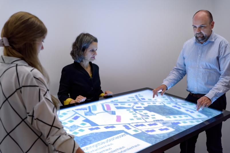
How much CO2 emissions could be saved if more buildings were constructed from wood is calculated by a new software tool developed by a research team from Ruhr-Universität Bochum (RUB) together with Disy Informationssysteme from Karlsruhe. The tool can be used to calculate and visualise the savings potential for specific residential areas, streets or individual buildings in a municipality.
The team headed by Professor Annette Hafner from the Chair for Resource Efficient Building collaborates with the RUB Chair of Environmental Engineering and Ecology led by Professor Harro Stolpe and industrial partners in the “Holzbau-GIS” project, funded by the German Federal Ministry for the Environment, Nature Conservation and Nuclear Safety and the German Federal Ministry of Food and Agriculture. The project has been running since spring 2019 and aims to provide planners and decision-makers at local authorities with a simple tool for assessing the benefits of energy-saving measures and timber construction in their communities.
First software prototype available
A first implementation of the tool with data sourced from the municipality of Menden in the Sauerland region, Germany, has already been completed. It is based on a model developed by RUB that analyses the potential for timber construction and energy-efficient redevelopment at municipal level, and on a digital city model in which all buildings and building types are listed. Users can deploy the tool to compare different scenarios for selected areas, such as new buildings based on wood or other materials or renovations with and without wood as a raw material. The tool calculates how much CO2 would be saved by the respective measures. If the city model contains the necessary data, various filters are also possible: for example, users can opt to view only residential buildings, only commercially used buildings or only urban buildings.
The software provider Disy is responsible for the implementation of a practical demonstrator system that is efficiently connected to the data sources of the local government. The first prototype is based on the geodata analysis platform Cadenza. Priority is given to user-friendly interaction mechanisms for defining, planning and comparing scenarios. As part of the project, the partners are also exploring the option to provide interfaces to statistical programmes for experienced users.
By the end of the project in 2022, an application that can be transferred to other municipalities is to be developed, provided that the data basis allows this to be realised.